This post may contain affiliate ads at no cost to you. See my disclosures for more information.
With the start of the school year in mid-August, the kids and I began diving in earnest into our geography lessons. We started with a series of activities to learn about maps and directionality. The Montessori mapping activities I’m sharing in this post come mostly from our KHT Montessori geography album. (I received the album when I took KHT Montessori’s online training course, but as of this writing you can get a free copy of the geography album if you sign up for Deb Chitwood’s newsletter at Living Montessori Now.)
All of the Montessori mapping activities below were designed to introduce my children to what maps are, what maps are used for, the symbols on maps, and how to use a map. We also read a number of books about maps and globes during the days we were doing these mapping activities, and those books really complemented the activities I share below.
Note: You can find more kid-friendly geography activities on my geography unit study page.
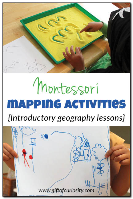
Primitive map drawing
The goal of this activity was to introduce my kids to maps, and more specifically, to introduce them to the fact that maps use symbols to represent real objects.
I prepared the activity by creating a control sheet showing symbols that included a moon, mountains, tree, river, and teepees. I presented the control sheet to my kids along with a tray filled with yellow craft sand. (The picture below shows the images already drawn in the sand, but the sand was a blank slate when I presented the tray to my kids.)
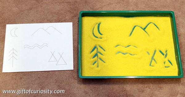
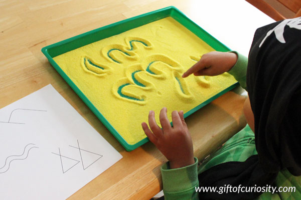
I showed my kids how to use their fingers to draw symbols in the sand. And then I gave them an opportunity to draw symbols as well. My son really loved this activity. It was easy to “erase” his primitive map with just a simple shake of the tray so he could draw the symbols over and over again.
Mapping a place setting
This goal of this next activity in which we mapped a place setting was to help my kids understand that maps represent real places, and they tell us where things go. To do this activity, I put two sheets of poster board on the table (one for each kid) and then invited my kids into the kitchen.
I then asked the kids to get out everything they would need for a meal and to set the table accordingly. (This was also a great opportunity to reinforce where everything goes in a place setting!) They set everything on top of the poster board.
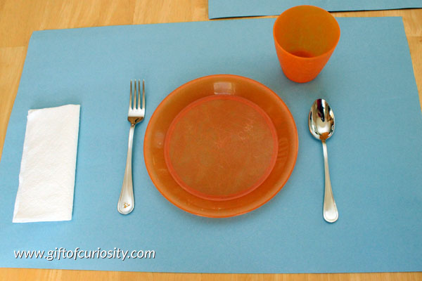
I then invited them to use a pencil to trace around all of the objects on their poster boards to show where each item goes.
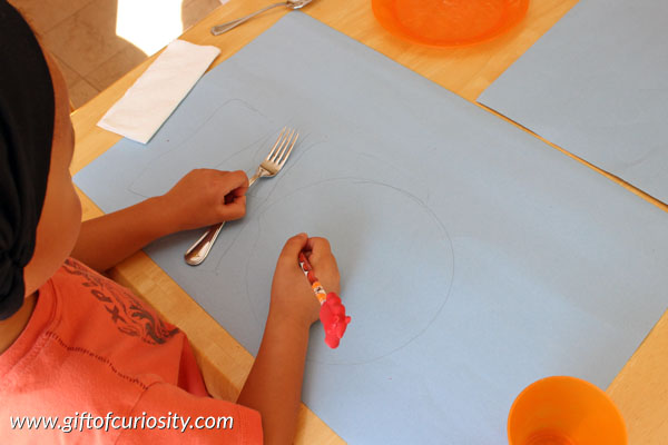
When they finished, they were so excited to have a map of their place setting. They wanted to use their maps as placemats for the next meal. 🙂
Mapping a room
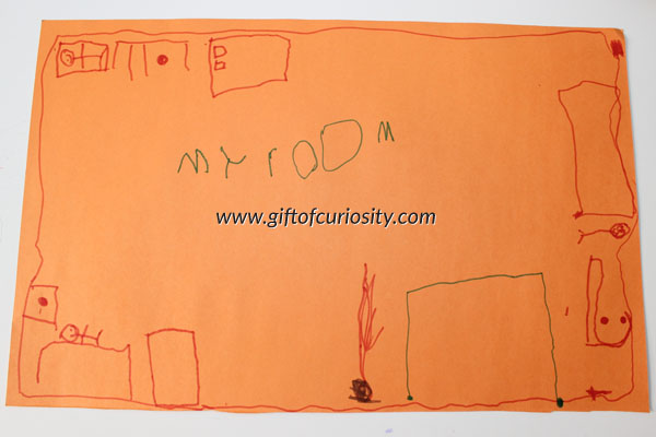
After mapping a place setting, I thought they were ready to tackle a more challenging mapping assignment – mapping their room! My kids share a room, so one day I walked in their room with them and sat down with pencil and piece of paper. I asked them to observe while I drew a map of their room. I included their beds, their desks, their dresser, their closet, their windows, and their book basket. I then labeled the map to indicate that it was their oom and drew a simple key to say what the objects were.
After I finished mapping their room, I invited them to make their own maps. Here is a picture of my daughter’s finished map. It wasn’t drawn to scale, but she did a great job of including all of the elements that make up her room! And since every map needs a title, she even labeled it “My room.”
Drawing maps of anything and everything
During our pirate unit, which coincided with our geography unit, we read the book How I Became a Pirate by Melinda Long. In the story, a young boy helps a band of pirates bury some treasure in his backyard. He then draws up a map of his backyard to show the pirates where the treasure is buried.
My kids got really excited about maps during this unit, so my daughter took it upon herself one day to recreate the map from the book. I thought she did an excellent job representing all of the objects from the map in the book. She even drew a very basic compass rose at the bottom.
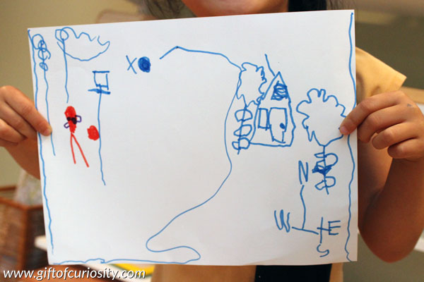
This was just one of many random maps my kids drew during this time. It seemed like every time I turned around they had drawn another map from a book or from their imagination.
Go on a treasure hunt
For this next activity, I created a map of our entire house, including the kitchen, living room, dining room, bedrooms, and bathrooms. I included virtually all the big pieces of furniture on the map (e.g., tables, chairs, beds). (If your kids are younger or are simply not ready, I would suggest doing a map of just one room rather than a whole house.)
After preparing the map, I created a small ‘X’ on the sticky part of a sticky note pad, and cut it to size so I just had a small ‘X’ on a piece of paper about 1/2 inch by 1/2 inch square. I set up the activity by hiding two pieces of “pirate gold” somewhere in the house. Then I invited the kids to come see the map.
My son shocked me by immediately recognizing the map as being a map of our house. My daughter needed a bit more orientation, but it wasn’t long before she too understood what each item on the map represented.
I then placed the ‘X’ on the map to show where I had hidden the “treasure,” and I sent my kids off in search of the pirate gold.
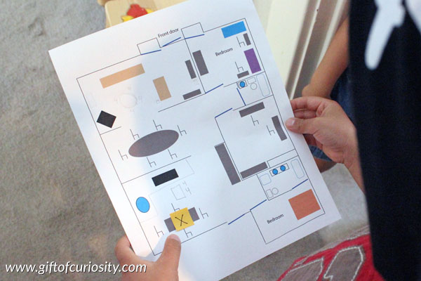
After they found the treasure, I hid more treasure in a new spot and moved the ‘X’ on my map accordingly. After my kids took several turns finding the treasure I had hidden, I gave them a chance to hide the treasure and mark the spot on the map for me to find. They loved, loved, LOVED this activity!
Make a map of our street
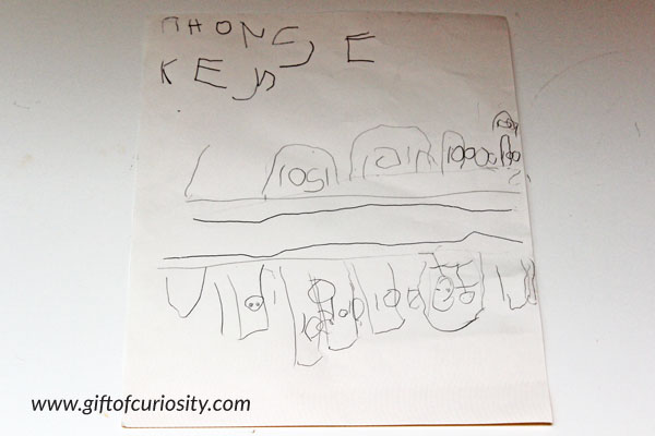
The last mapping activity we did – at least for the time being – was to make a map of our street. One morning my kids and I all went outside with a pencil, a sheet of paper, and a clipboard. We worked together to make a map of our street, focusing just on the few houses on either side of our house on both sides of the street.
Here is my daughter’s map of our street. She was adamant about including the key at the top to explain what the symbols meant, which was really cute. 🙂
More geography resources
More geography posts from Gift of Curiosity:


How nice to see that what I have been doing for 15 years has come to the web!
Really great ideas! How old are the kids you do these activities with?
My kids were just starting kindergarten when we did most of our mapping activities, but according to Montessori you can begin some of these activities as young as three-years-old if kids are ready for them. It really depends on the child.